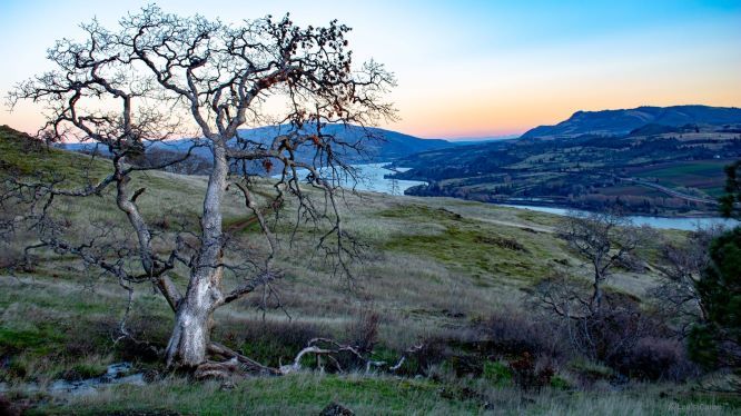
Come Fly With Us!
We specialize in Environmental Permitting, Unmanned Aircraft Systems Data Collection, and Aerial & Terrestrial Photography / Video
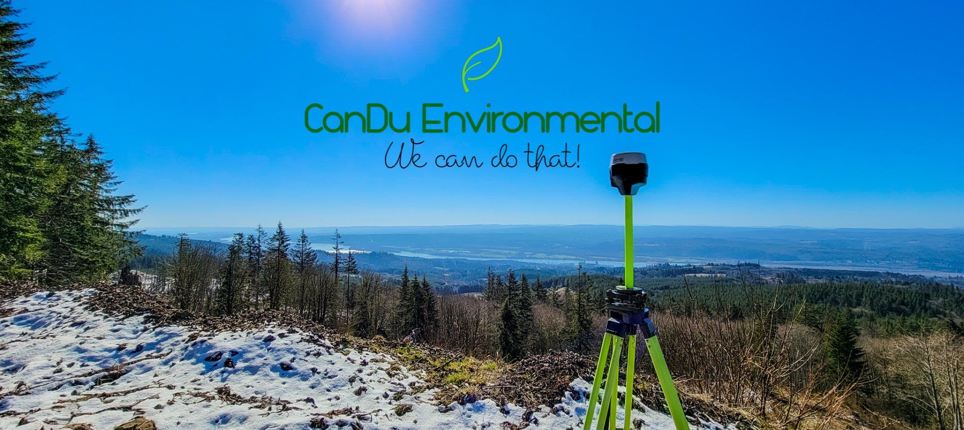
About us
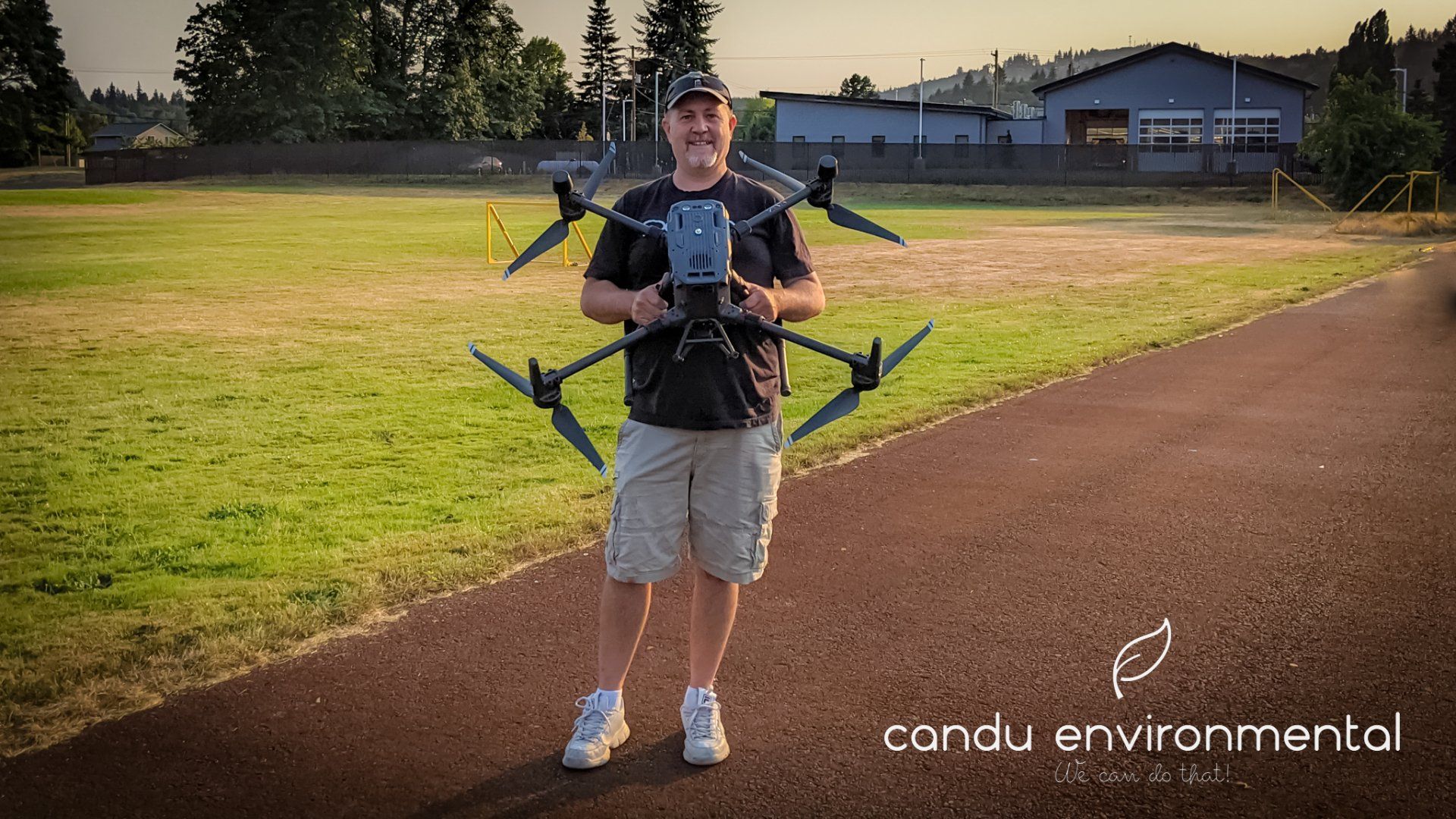
Hi. My name is Ron Melin, owner and operator of CanDu Environmental, LLC. CanDu is a relatively new venture started in 2021. Prior to opening CanDu, I worked for over 15 years as an environmental planner, planning manager, project manager, SEPA responsible official, shoreline administrator, and floodplain manager for local government. I am a graduate of Huxley College of the Environment at Western Washington University with degrees in Environmental Science and Stream Ecology. I am also a FAA Part 107 Certified UAS (Drone) Pilot.
At CanDu Environmental, LLC we strive to help our clients negotiate the development permitting minefield created by today's increasingly tough and often confusing environmental regulations.
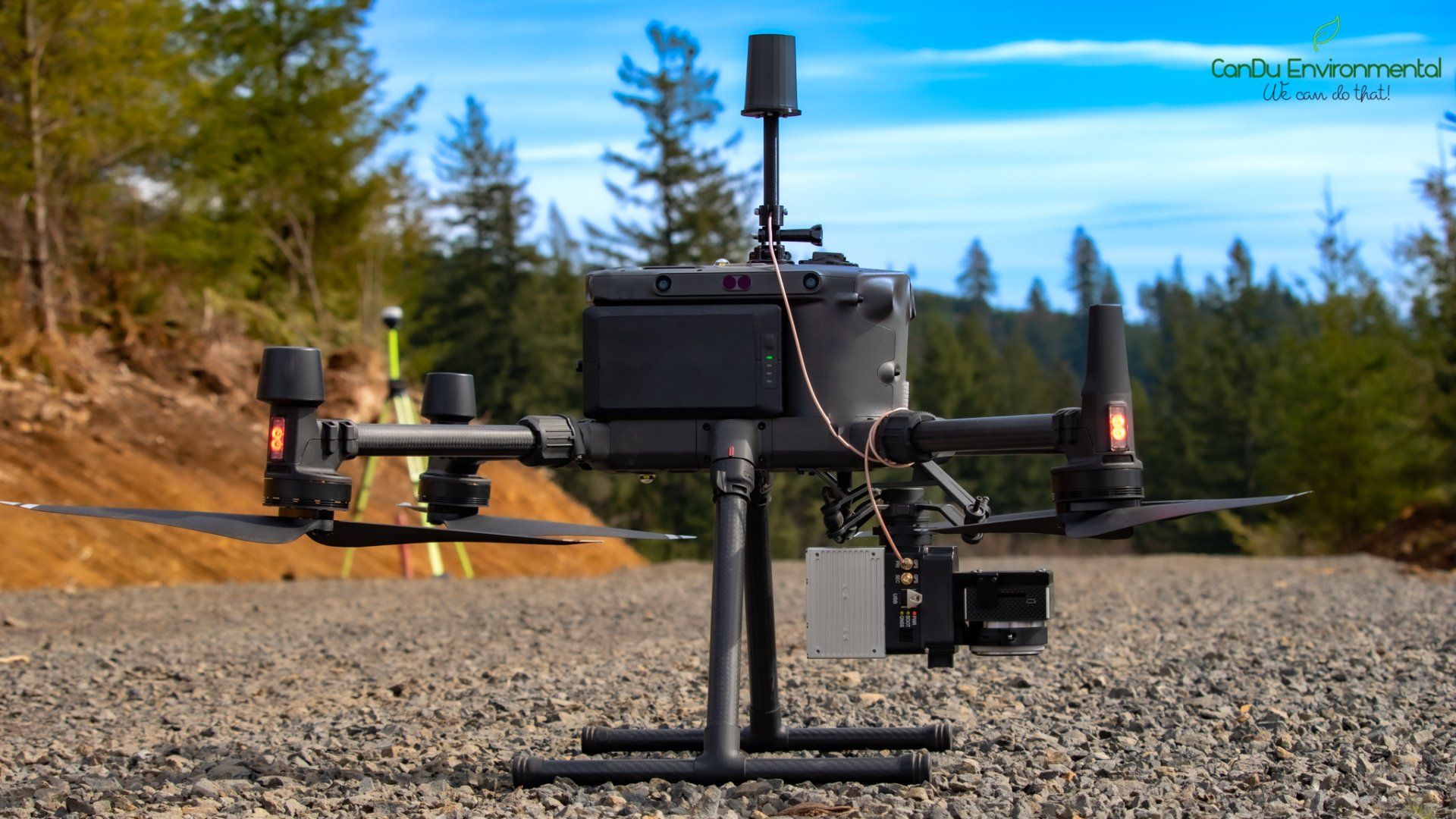
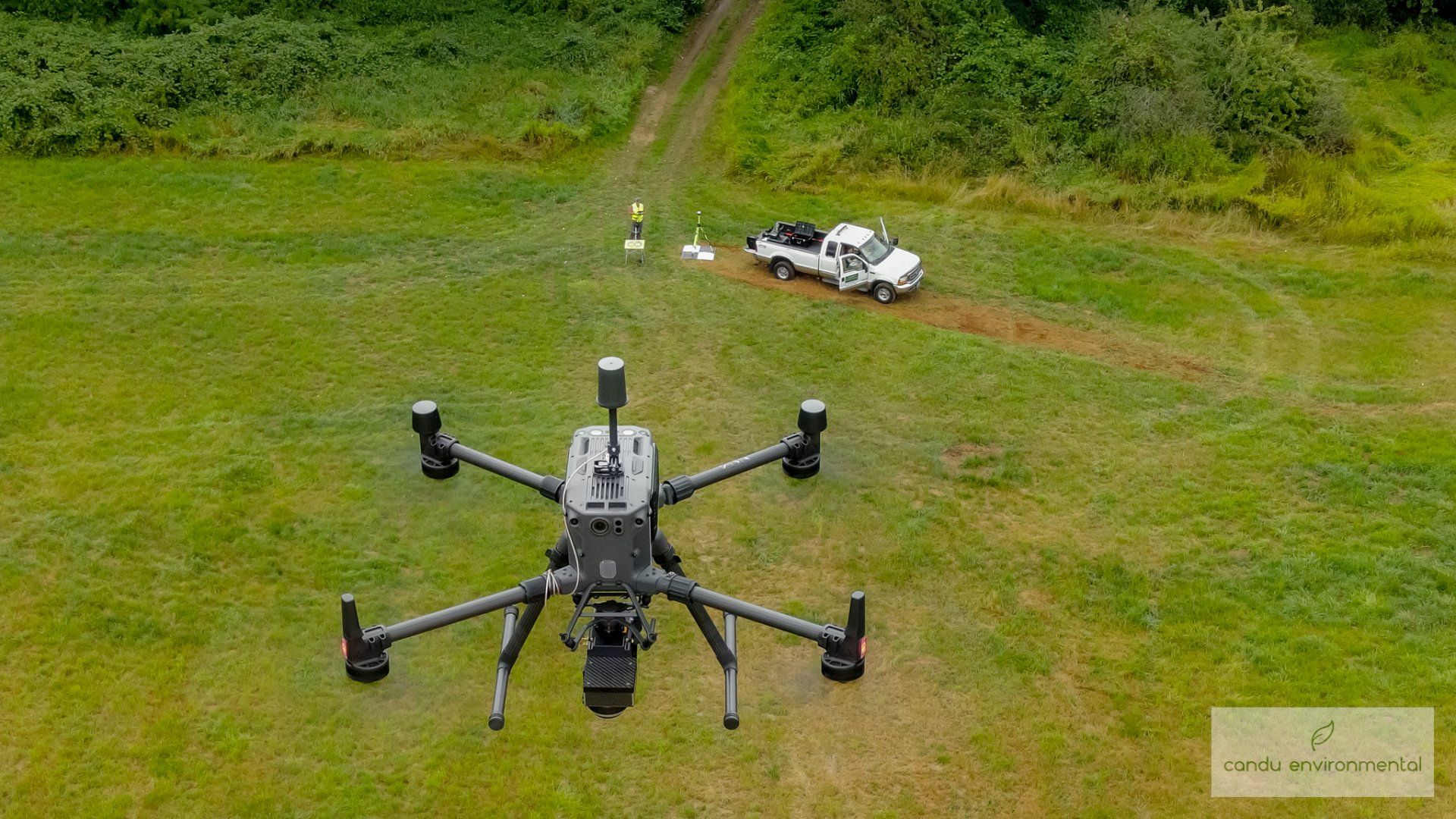
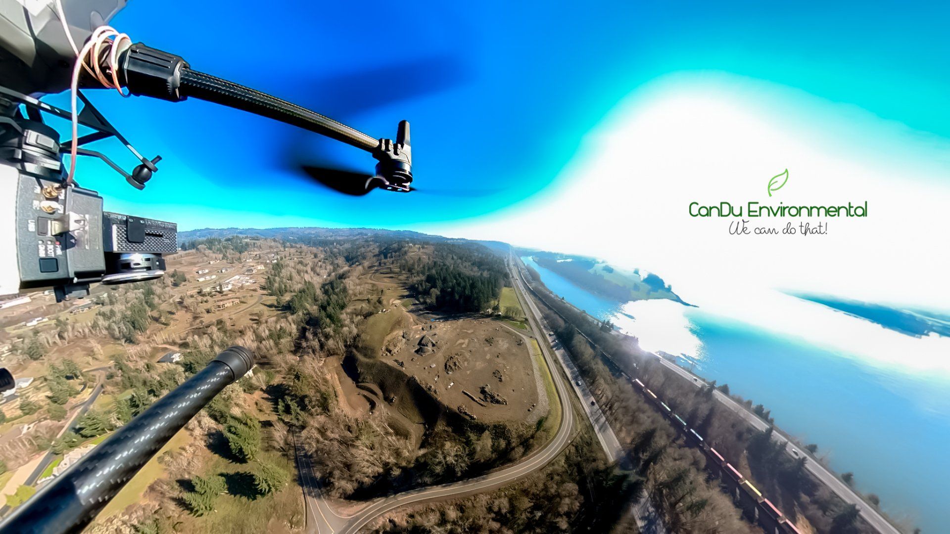
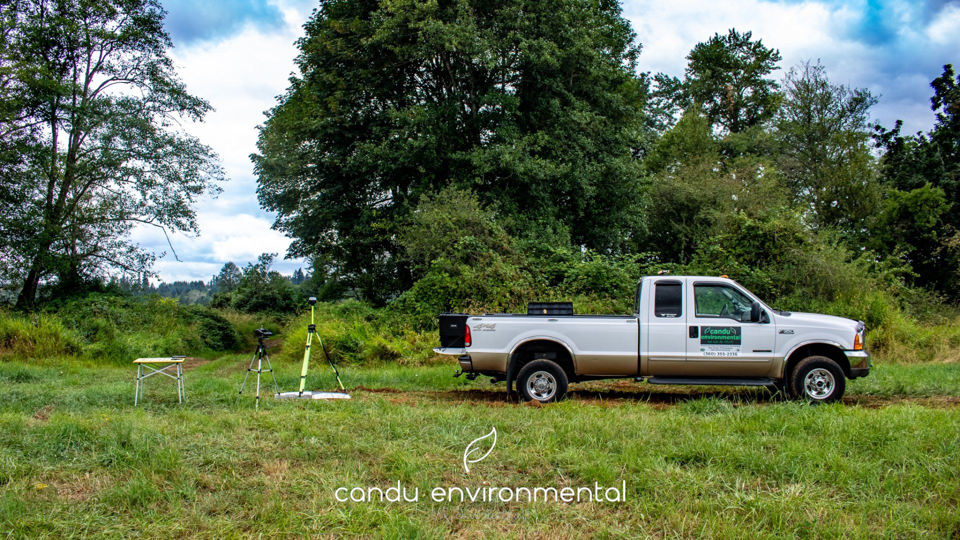
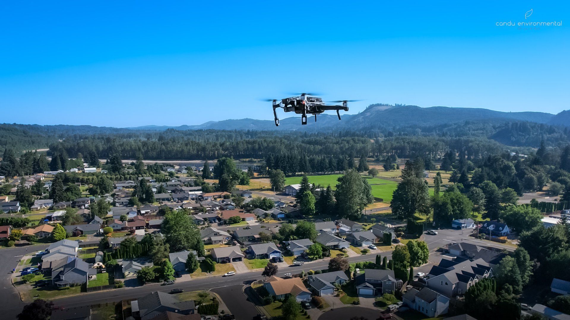
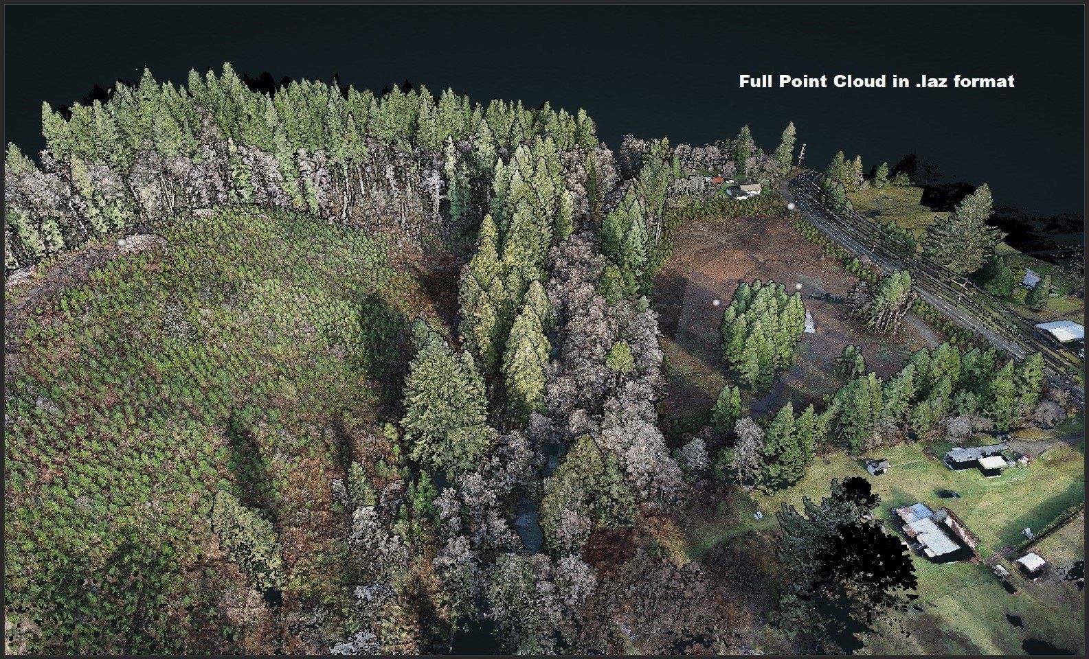
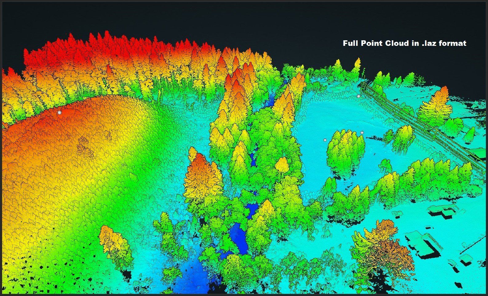
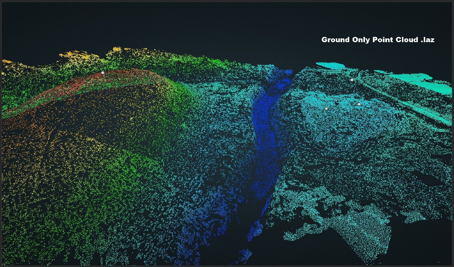
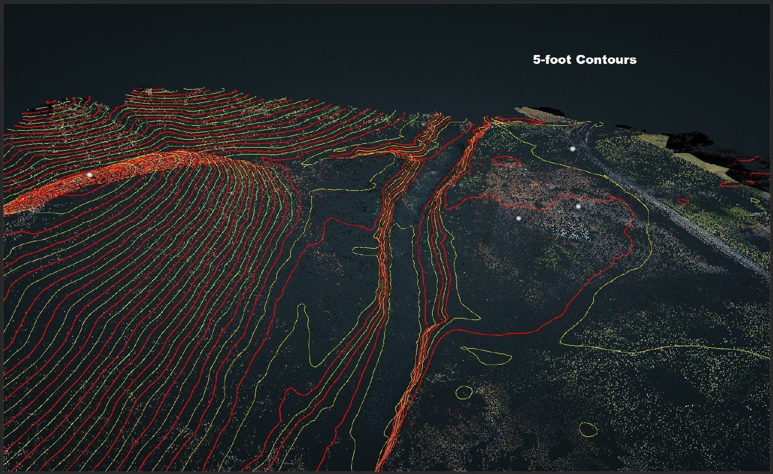
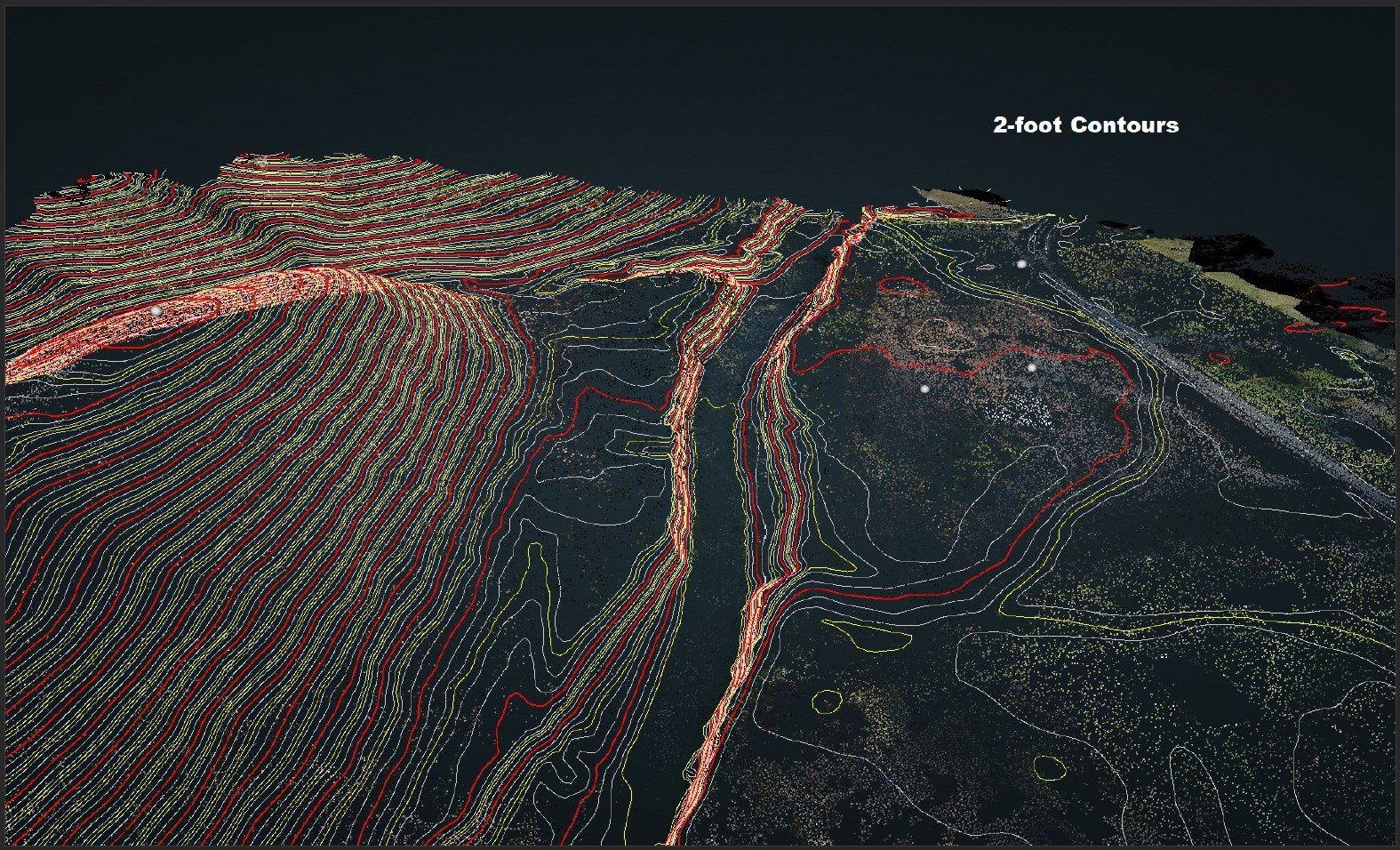
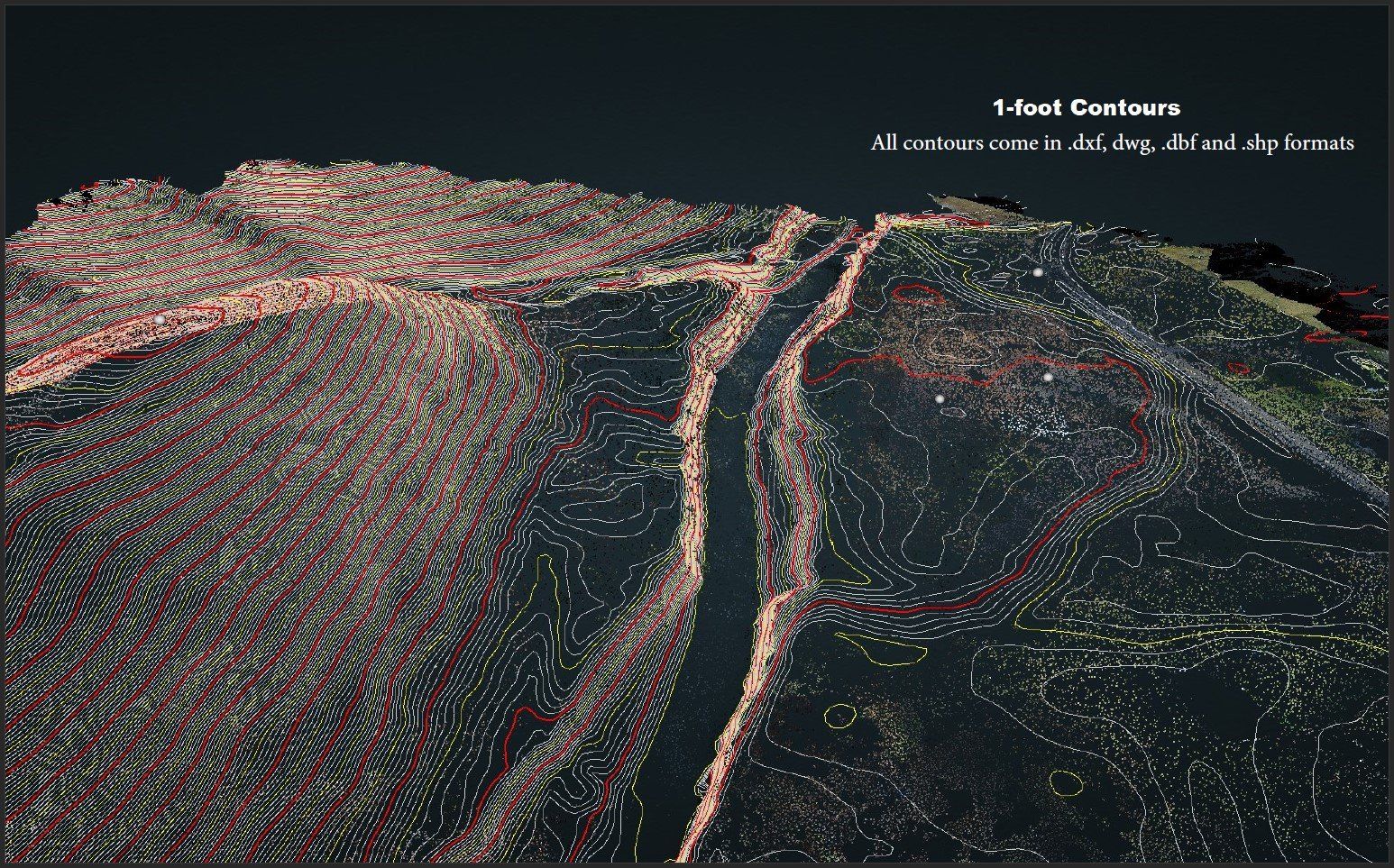
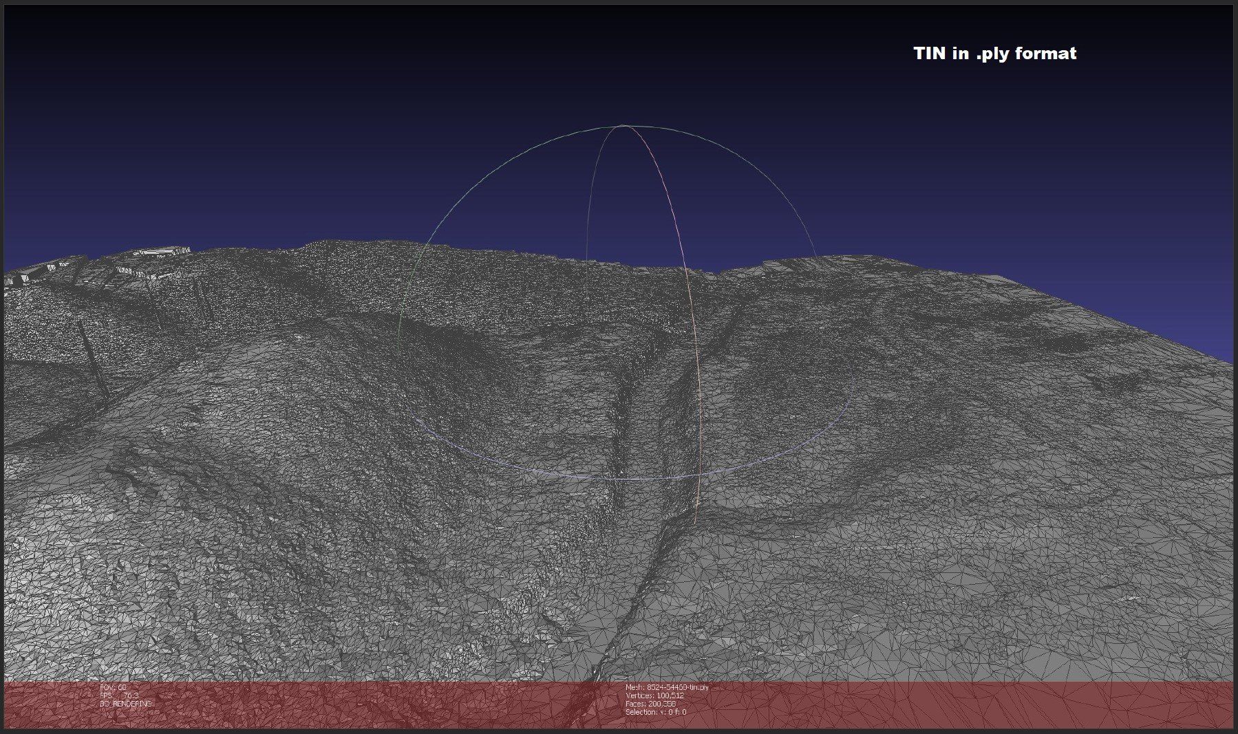
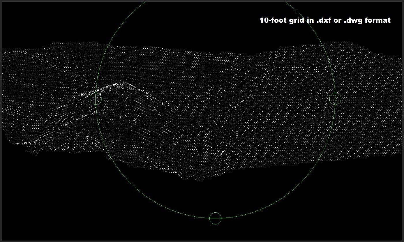
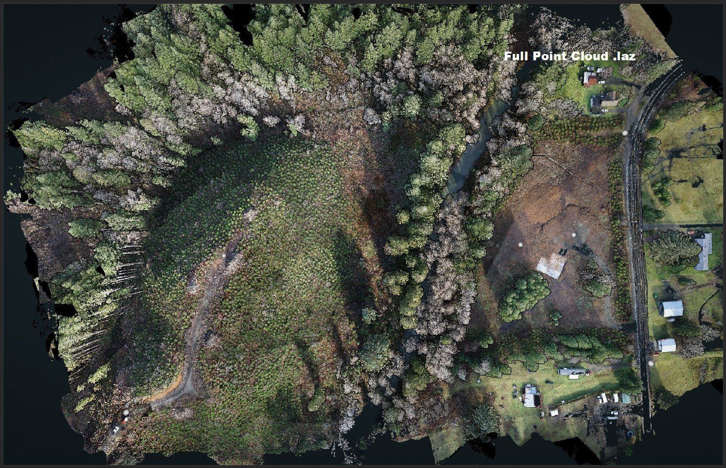
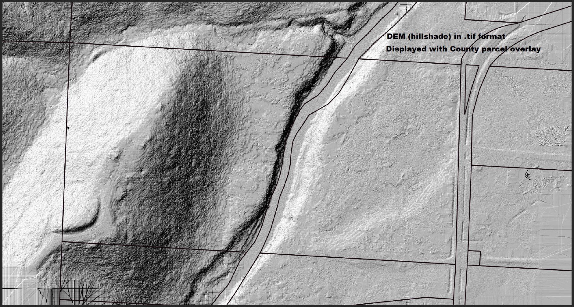
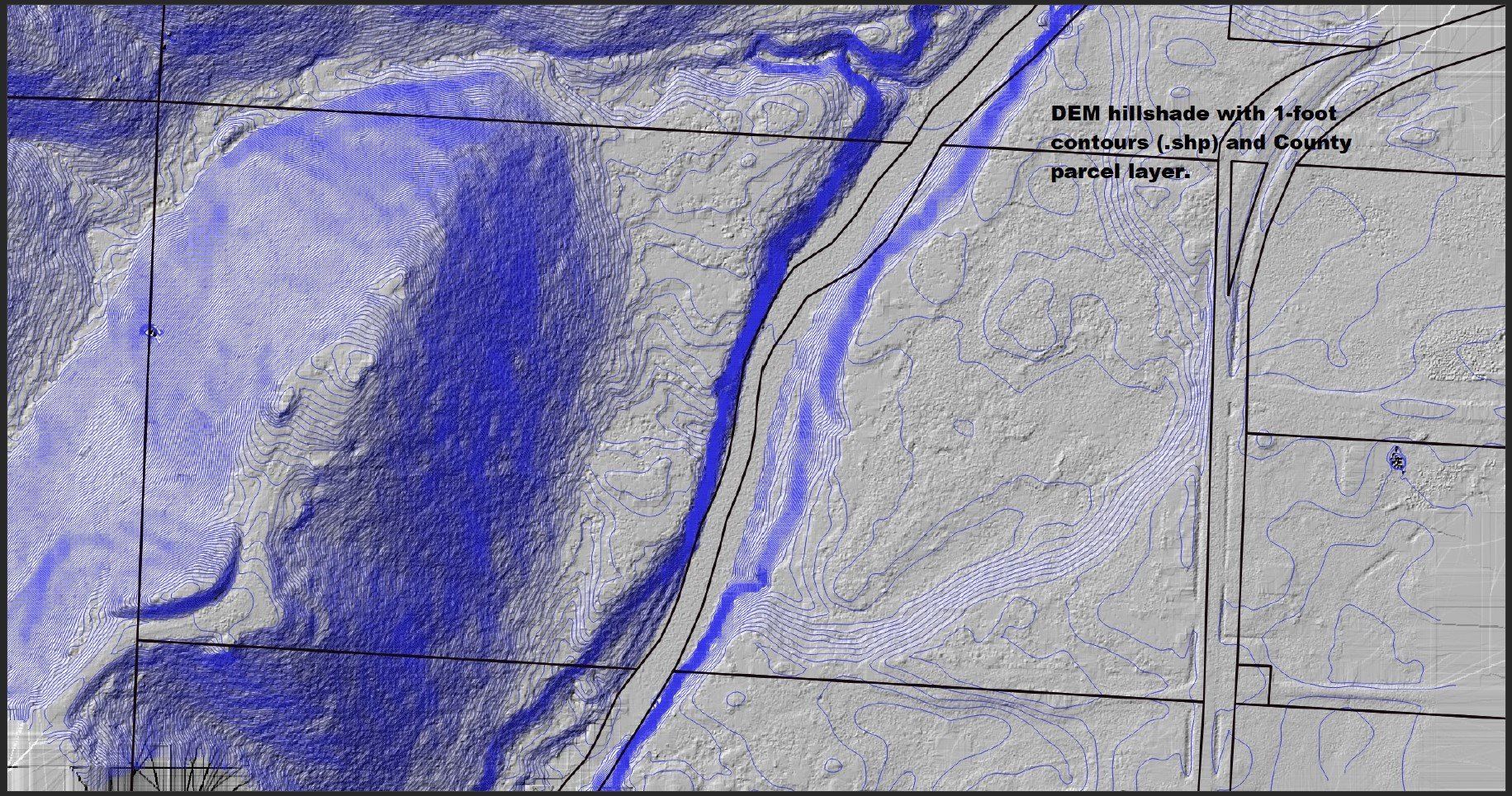
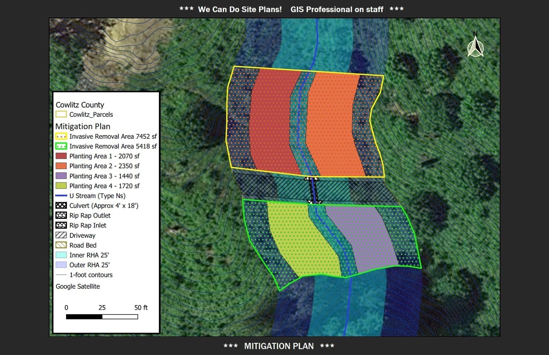
We also offer unmanned aircraft system (UAS) LiDAR mapping and photogrammetry services. We can collect ground data for you to share with your design professionals; we can also monitor the progress of your development from start to finish.
When you're all done with your project and have decided to sell, we can provide real estate photography services, as well.
We are passionate about what we do and we are invested in developing a personal connection with each and every one of our clients by providing prompt, quality service. Get in touch with us when you're ready to learn more; we can't wait to meet you, and we're excited to help you reach your development dreams!
Our services
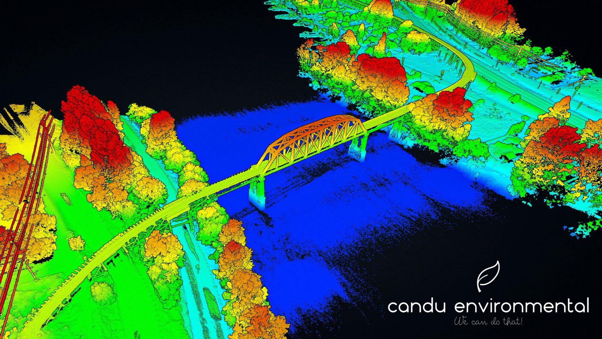
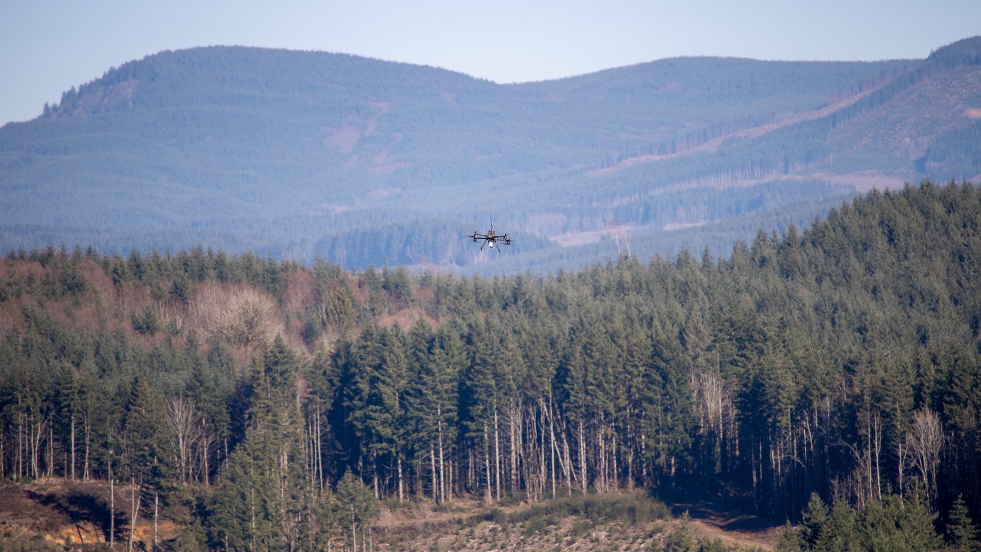
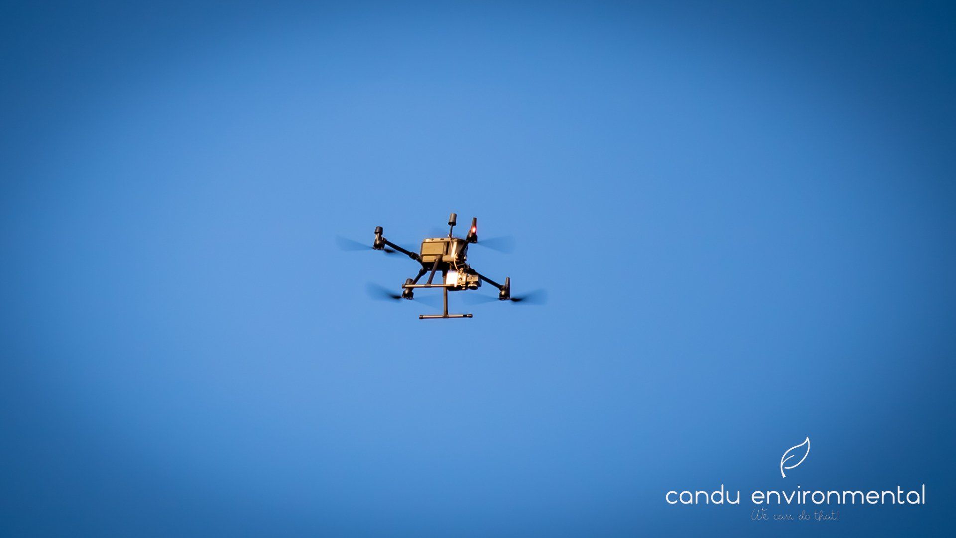
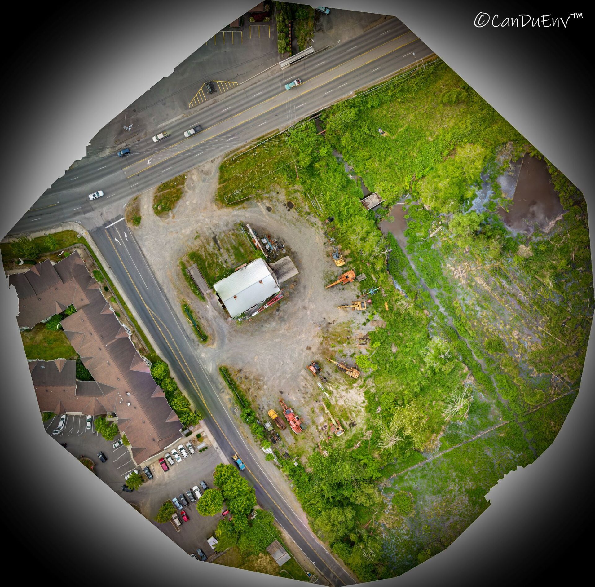
UAS Drone Services / LiDAR / Photogrammetry / Infrastructure Inspection / Vegetation Management / Aerial Photography and Video
We own a fleet of drones with various payloads that can tackle whatever job you need done. You want pretty pictures and video? We can do that. You want invaluable tools to provide to your design team? We can do that, too. We use state of the art drone LiDAR and photogrammetry mapping technology to create aerial photos, georeferenced orthophotos, digital elevation models, and 3-D models of your project or project site. These tools are useful for countless applications such as accurately tracking the progress of your development from start to finish, stockpile analysis, helping design roads and stormwater conveyance, designing habitat restoration projects, etc... The sky's the limit!
Full disclosure: We are not licensed or certified surveyors or engineers; however, our deliverables can be an invaluable tool for your design team and we can work with your licensed surveyor to provide the data they need.
We have an FAA Part 107 Remote Pilot on staff waiting to fly your mission. Let us know what we can do for you!
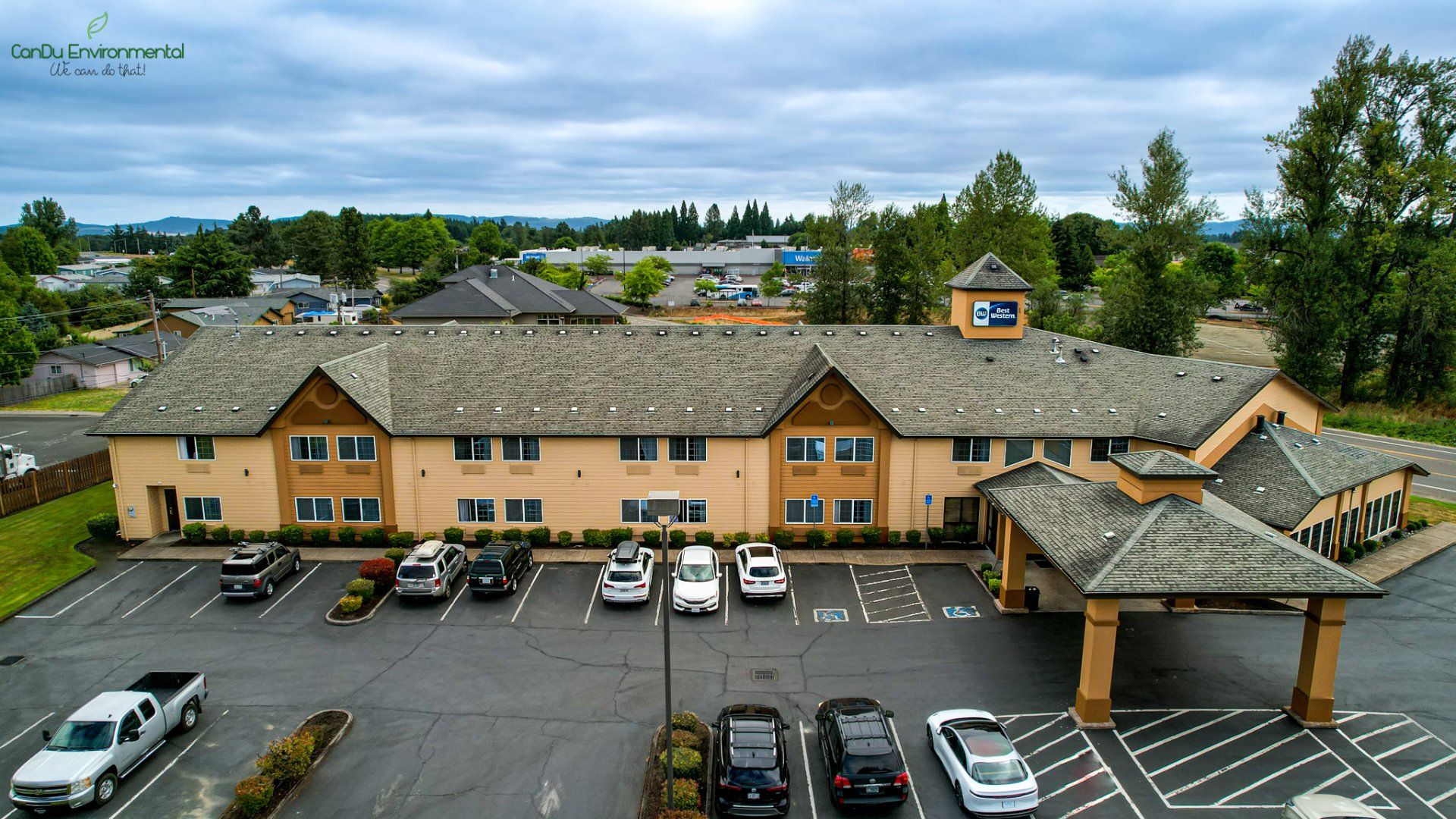
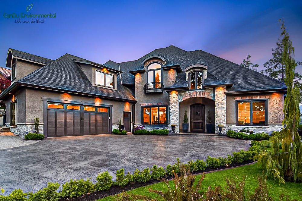
Residential, Commercial, and Industrial Real Estate Photography
Finished with your development and looking to profit from your hard work? We can help! We have an FAA certified drone pilot and professional photographer on staff. We can make your real estate listing jump off the page with beautiful, eye-catching interior, exterior and aerial photos. Call or email us to set up a consultation.
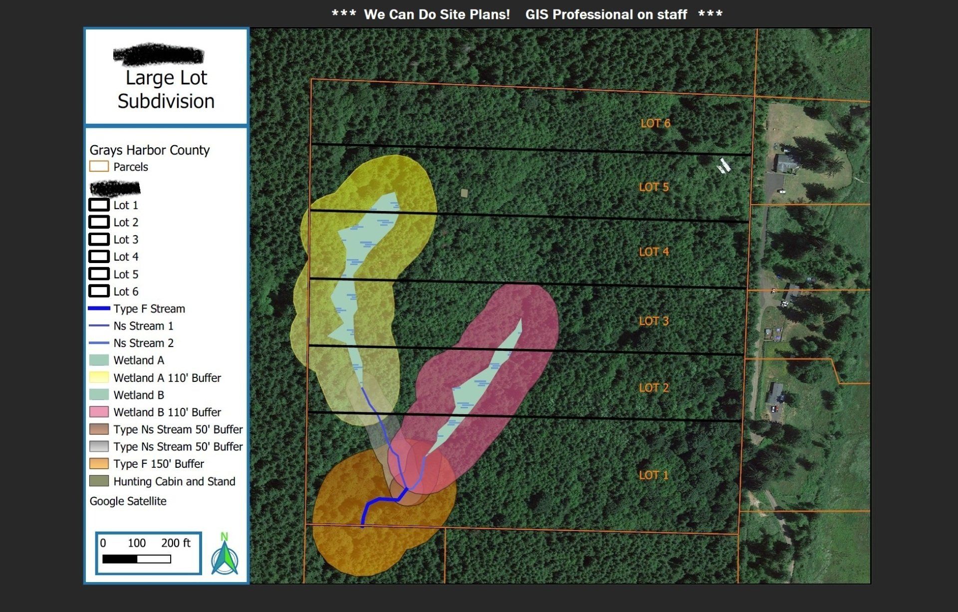
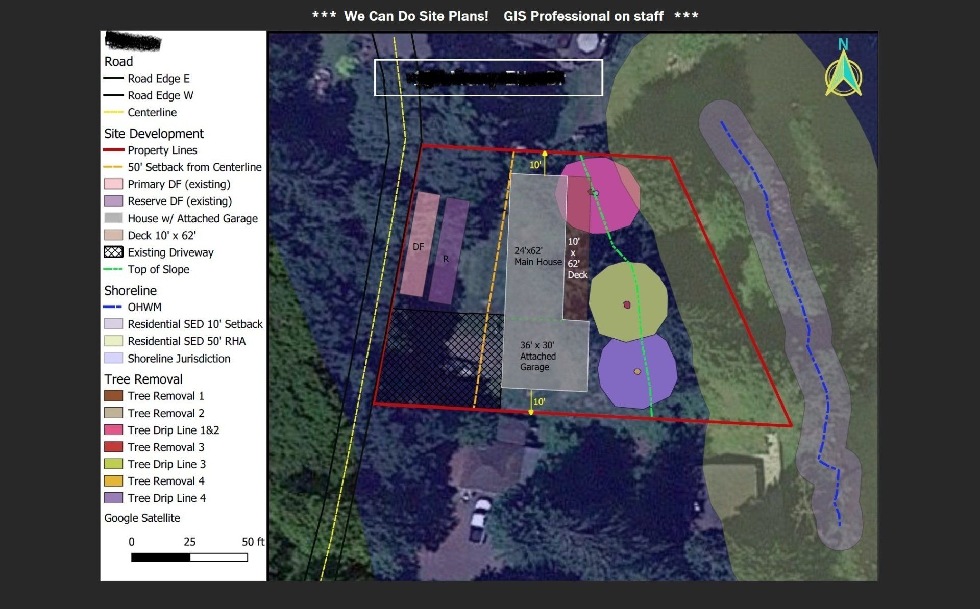
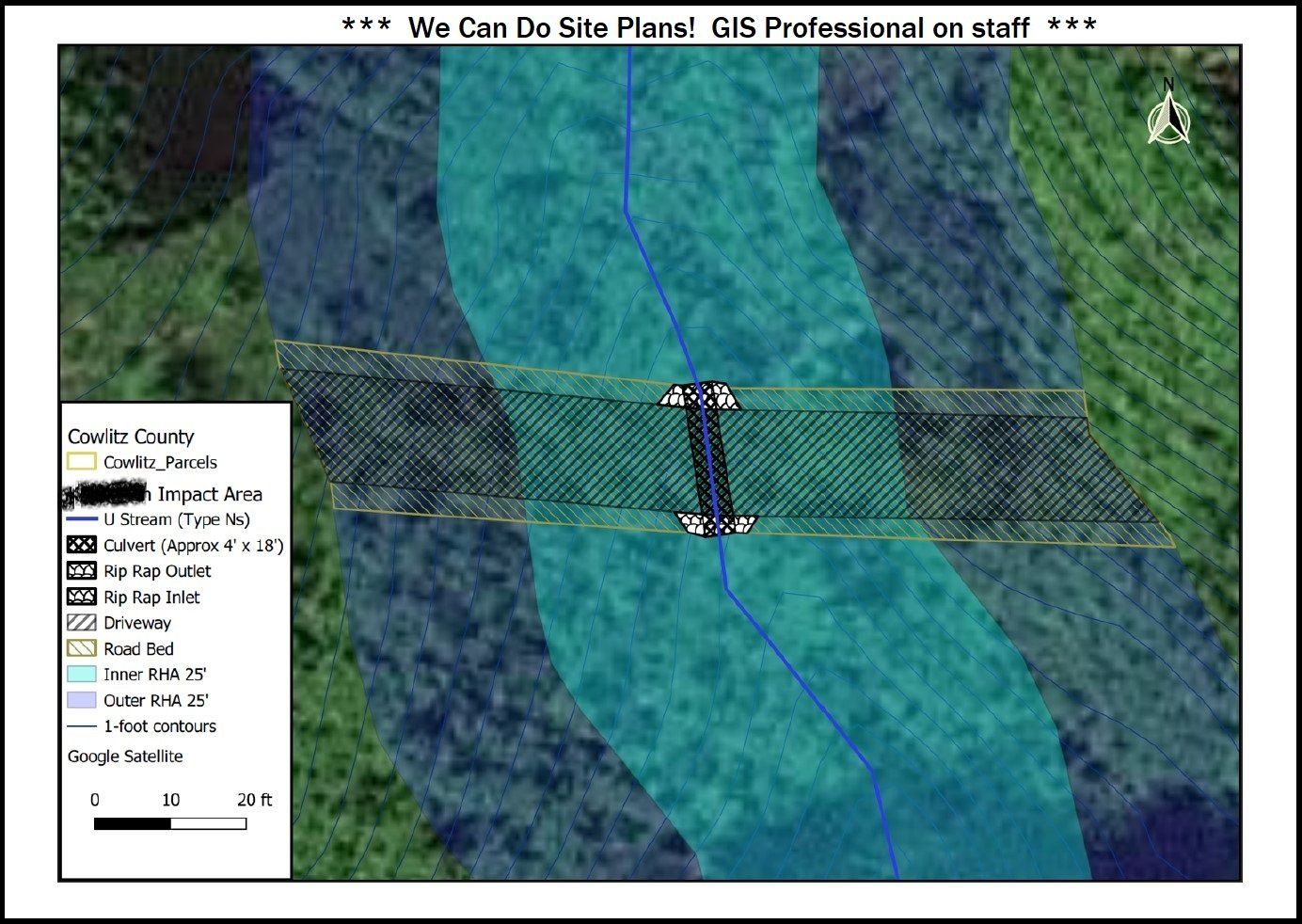
General Planning and Permitting Services / Site Plans / Feasibility Studies / Due Diligence Reports

Critical Areas Permitting / Mitigation Plans

Shoreline Permitting / SEPA Compliance

Reasonable Use Exception Reports

Customer reviews

Daniela K.

Rhonda H.

James F.
Special features

Competitive pricing

Licensed professional

Custom service